Chronolocation: Estimating When a Photo Was Taken
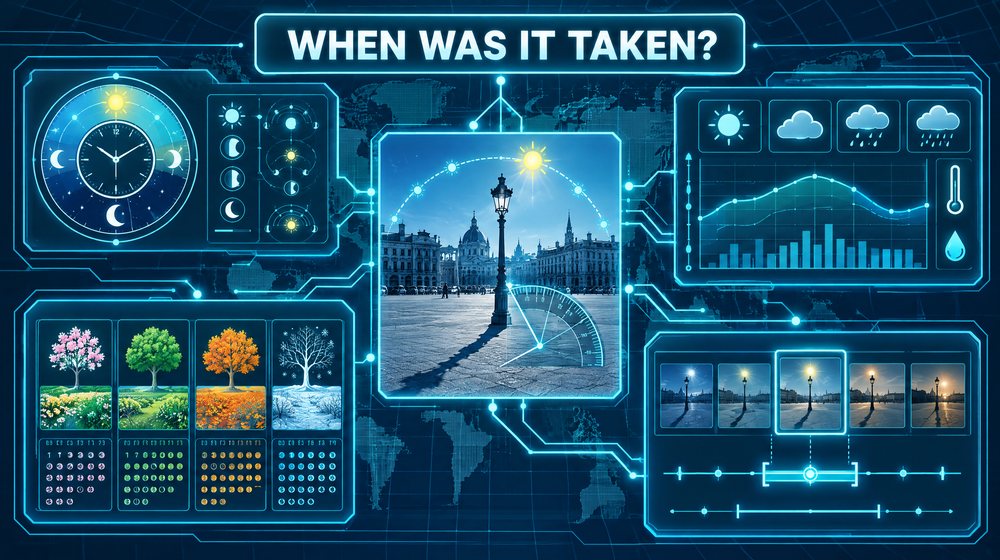
Geolocation asks where a photo was taken. Chronolocation asks when. The two questions are linked, because the most reliable clock in an outdoor photo is the sun, and reading the sun requires knowing where you are standing. Chronolocation rarely gives you an exact minute. What it can do, when done carefully, is test a claimed time, rule out impossible ones, and produce a window with honest error bars. This guide explains how to combine shadows, sun-position tools, weather records and seasonal cues, and how to weigh them against file metadata.
Begin with what the claim says
Chronolocation is usually a test of a claim. A post says "this was taken this morning", a seller says "photographed last week", or a witness says "around five in the afternoon". Write the claim down precisely, including its time zone if one is stated, before you analyse anything. Your job is to determine whether the visual evidence is consistent with it, inconsistent with it, or unable to decide.
You also need a location. If the photo has not been geolocated, do that first or work from a stated location and treat your result as conditional on it. The sun's position depends on latitude, longitude, date and time together.
Metadata versus visual evidence
What metadata can offer
If you have an original image file, its EXIF metadata may include a capture time. The DateTimeOriginal field records when the camera says the photo was taken. Newer versions of the EXIF standard added offset fields such as OffsetTimeOriginal, which record the difference from UTC, but many files do not include them. Tools such as ExifTool read these fields reliably.
Why metadata is not the answer
- It reflects the device clock, which may be wrong, set to the wrong time zone, or not adjusted for daylight saving time.
- Without an offset field, a timestamp has no time zone. "16:40" is ambiguous until you know whether the camera was set to local time or UTC.
- Most social platforms strip EXIF on upload, so copies downloaded from them usually carry none.
- Metadata is easy to edit. Its presence proves nothing on its own.
- File system dates such as "created" and "modified" usually reflect when the file was copied or saved, not when the photo was taken.
One timestamp you can usually trust as a boundary is the time the image was first published. A photo cannot have been taken after it was posted. Find the earliest copy you can and record its posting time as the latest possible capture time.
The sound approach is to treat metadata as one more claim. If the visual evidence agrees with it, your confidence rises. If they conflict, the visual evidence usually wins, because it is much harder to fake consistently.
Reading shadows
Shadows carry two measurements: direction and length. Each relates to a different property of the sun's position.
Shadow direction and solar azimuth
A shadow points directly away from the sun. If you can establish the compass direction of a shadow, you know the sun's azimuth: the shadow's direction plus or minus 180 degrees. To find the shadow's direction, you need a reference with a known orientation, such as a straight road, a building edge or a wall whose bearing you can measure on satellite imagery of the geolocated site.
In the northern hemisphere outside the tropics, the sun is in the southern half of the sky at midday, so shadows point roughly north around noon, towards the west-north-west in the morning and towards the east-north-east in the afternoon. In the southern hemisphere the pattern mirrors.
Shadow length and solar elevation
Shadow length tells you how high the sun is. For a vertical object on level ground, the sun's elevation angle satisfies a simple relationship: the tangent of the elevation equals the object's height divided by the shadow's length. A one-metre post casting a one-metre shadow means the sun is 45 degrees above the horizon. A shadow twice the object's height means about 26.6 degrees.
You rarely know heights exactly, but you often know them roughly. Standard objects help: door frames, bollards, kerbs, road signs, parking meters, fence panels and brickwork courses. The ratio matters more than absolute sizes, so measure the object and its shadow in the same units in the image, along the same plane.
Practical difficulties
- Perspective. Shadows that run towards or away from the camera are foreshortened. Shadows running across the frame, roughly parallel to the image plane, are the easiest to measure.
- Sloping ground. A shadow falling uphill is shorter and downhill longer than on level ground.
- Non-vertical objects. Leaning poles, trees and people in motion give misleading ratios.
- Soft shadows. Under thin cloud or haze, shadow edges blur and length becomes uncertain.
- Lens distortion. Wide-angle lenses, including most phone cameras, bend straight lines near the edges of the frame.
Using sun-position calculators
Once you have an estimate of elevation, azimuth or both, a sun-position calculator tells you when the sun was in that position at your location.
SunCalc (suncalc.org) is a widely used free web tool. You set a location on the map and a date and time, and it draws the sun's direction, its path across the sky for that day, and the times of sunrise and sunset. It also reports the sun's altitude and azimuth, and can show the shadow length for an object of a given height. Moving the time slider while watching the azimuth and altitude values is the fastest way to find matching times.
The NOAA Solar Calculator is a free cross-check that returns solar azimuth and elevation for a place and time.
Always confirm which time zone the tool is displaying, and whether it has applied daylight saving time for the date you entered. Many errors in chronolocation are simply time zone mistakes.
Two built-in ambiguities
Sun position has two symmetries you must account for:
- Within a day. The sun reaches the same elevation once in the morning and once in the afternoon. Shadow length alone cannot tell them apart. Shadow direction can.
- Within a year. The sun's path on a given date is very similar to its path on the date the same distance on the other side of the solstice. A shadow geometry that fits late August will also fit a date in late April. Seasonal cues are what separate them.
Weather records
Weather is the next independent check. If a photo shows clear sky, wet roads, snow or heavy cloud, historical records can confirm or contradict the claimed date.
- Airport observations (METARs). Most airports publish routine observations at least hourly, recording cloud, visibility, precipitation, temperature and wind. Archives are freely available, for example through the Iowa Environmental Mesonet. The nearest airport may be some distance away, so allow for local variation.
- National weather services and climate archives, such as NOAA's National Centers for Environmental Information in the United States, publish station data.
- Aggregators such as Meteostat and Weather Underground's history pages are convenient, though you should note which station each value came from.
- Satellite imagery. NASA Worldview shows daily true-colour satellite images that reveal broad cloud cover and snow on a given day.
Weather evidence is strongest when it rules something out. Crisp shadows on an afternoon the nearest station recorded as overcast and raining is a meaningful contradiction. Agreement is weaker, because many days share similar weather.
Seasonal and contextual cues
Seasonal cues resolve the twin-date problem and narrow the window further:
- Vegetation. Bare branches, fresh pale leaves, full summer canopy, autumn colour, flowering species and the state of crops in fields.
- Clothing. Coats versus short sleeves, though people dress unpredictably.
- Decorations and events. Holiday decorations, election posters, advertising for dated events, sports fixtures.
- Construction. Scaffolding, new buildings or roadworks visible in dated satellite or street-level imagery can bracket a date.
- Shop signs and prices. A business that opened or closed on a known date sets a boundary.
A worked example
Suppose a local newsroom receives a photo of a protest gathering in a town square. The sender claims it was taken "this afternoon, 22 August", and the newsroom wants to know whether the image is genuinely current or recycled from an earlier event. The square has already been geolocated to a town at about 52 degrees north, close to the prime meridian, in a country using UTC+1 in summer.
Metadata. The file came via a messaging app and has no EXIF data. The earliest posting found online is at 18:10 local time on 22 August, which sets the latest possible capture time.
Shadow direction. A bollard near the camera casts a shadow running along the edge of the square. Satellite imagery shows that edge runs at a bearing of about 68 degrees, roughly east-north-east. The sun's azimuth was therefore about 248 degrees, in the west-south-west. That puts the photo in the afternoon.
Shadow length. The bollard is a standard type you estimate at 1.0 metre tall, plus or minus 0.1 metres. Its shadow, measured against paving slabs of known size, is about 1.7 metres. That gives a solar elevation of about 30.5 degrees, with a range of roughly 28 to 33 degrees given the height uncertainty.
Sun calculator. At that location on 22 August, the sun stands at about 30.5 degrees elevation and 248 degrees azimuth at around 16:40 local time. Allowing for the height uncertainty, the window runs from about 16:25 to 17:00 local time. That fits the claim of "this afternoon" and sits before the first posting.
The twin date. The same geometry occurs at almost the same local time around 20 April. You check the trees in the square: they are in full, dark summer leaf. Street-level imagery from April in a previous year shows the same trees only just coming into leaf. That favours August over April.
Weather. The nearest airport's observations for the afternoon of 22 August show scattered cloud and no rain, consistent with the sharp shadows. On 20 April the same station recorded overcast skies and drizzle through the afternoon, which would also argue against April.
Conclusion. You report that the visual evidence is consistent with capture between about 16:25 and 17:00 local time in late August, and inconsistent with the main alternative date in April. You add that this does not rule out an afternoon in late August of a previous year. To address that, you compare features in the image, such as a newly installed bench and a shopfront that changed name, with dated street-level imagery, and find the shopfront name matches only imagery from this year.
Error bars: say what you do not know
Every input to chronolocation carries uncertainty, and the uncertainties combine.
- Height estimates of reference objects might be off by ten percent or more.
- Shadow measurements suffer from perspective, slopes and soft edges.
- Bearings taken from satellite imagery have small errors that matter when the sun moves quickly in azimuth.
- The sun's rate of change is not constant. Elevation changes slowly around midday and faster in the morning and afternoon. Azimuth can swing quickly around noon when the sun is high. The same measurement error therefore produces different time errors depending on the time of day.
Work through your estimate at the low and high ends of each uncertain input, as in the example above, and report the resulting range. A statement such as "between 16:25 and 17:00 local time, assuming the geolocation is correct" is far more useful, and far more defensible, than "16:42".
Common mistakes
- Time zone confusion. Mixing UTC, local standard time and daylight saving time is the most common error. Write the zone next to every time you record.
- Forgetting the twin dates on either side of the solstice.
- Measuring foreshortened shadows as if they were seen side-on.
- Trusting metadata without checking it against the scene.
- Treating weather agreement as proof. Plenty of days are sunny.
- Ignoring the year. Sun geometry repeats annually. Use dated features to separate one year from another.
- Skipping geolocation. A wrong location makes every sun calculation wrong.
Ethics and legality
Establishing when a photo was taken can reveal people's routines, such as when they leave home, when a building is empty, or when a child is collected from school. Apply the same test as for geolocation: work only with a lawful, authorized and proportionate purpose, and avoid producing timelines of private individuals' movements unless an authorized process genuinely requires it. When publishing chronolocation findings about public events, consider whether precise times could endanger people who appear in the images.
Checklist
- Write down the claimed time, date and time zone precisely.
- Confirm the geolocation first, or state that your result depends on it.
- Read metadata, treat it as a claim, and record the earliest posting time as an upper bound.
- Measure shadow direction against a reference of known bearing.
- Estimate shadow length ratio using objects of known height on level ground.
- Find matching times with SunCalc or the NOAA calculator, checking the tool's time zone.
- Resolve morning versus afternoon and the twin dates around the solstice.
- Check historical weather from named stations and satellite imagery.
- Use seasonal and dated features to narrow the date and the year.
- Report a time window with error bars and the assumptions behind it.